If you are fortunate in life, there are at least a few times along your path when you’ve found yourself somewhere in nature that takes your breath away with its beauty or when you’ve been given an opportunity to do something that really scares you or is very difficult and you do it anyway. The trek we made recently on the Milford Track was all of these things and more for me.
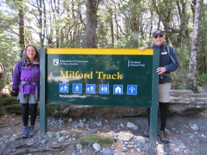
The Milford Track is considered one of the top ten hikes in the world (some say it’s #1) and is located in Fiordland National Park, which lies along the south-western coast of New Zealand’s South Island. The Milford is 33.5 miles long and goes from the top of Lake Te Anau, through a canyon, over a 3,300’ pass, and then along a river, ending at the Milford Sound. Each day, a maximum of 50 unguided and 40 guided hikers are allowed to begin this one-way trek.
The prep work for this adventure started months ago when Bill and I heard about the Milford Track online and from a colleague of Bill’s who had taken both of his daughters individually to do the Milford when they graduated from high school. The area’s beauty drew us in but we knew we were not in shape to do real backpacking at this point in our lives, so we signed up for a guided trip back in December with a company called Ultimate Hikes. When we left Ithaca, we made sure that we had clothing and gear for all kinds of conditions since the Milford is known for extreme and changeable weather (sun, rain, flooding, wind, snow and cold). In hindsight, we had no idea what we were getting ourselves into!
Normally, we like to do a fair amount of hiking but we knew we needed to build up our stamina in preparation for this trek. So, while in Hawaii and New Zealand, we focused on longer and more challenging hikes. Everywhere we’ve been in NZ, we’ve met people of every age that have done the Milford and all of them recommended wearing boots that support the ankles and using hiking poles. In the weeks before we left for Queenstown and the start of the trek, I was busy going over our gear and purchasing what we didn’t bring from Ithaca.
It was during this time that I realized that I had a fair amount of anxiety welling up about the track. Two weeks before leaving for Queenstown for the start of the Milford, we heard about a 68 year-old man who had fallen to his death on the trail –not what I needed to hear! The day before heading to Queenstown, I started to feel rather ill and run down and while attending the pre-track briefing on Wednesday night, I was seriously considering bailing out altogether. Nevertheless, this was a challenge that I didn’t want to back down from and I was determined to find out what the Milford was all about.
Day 1: Into the Deep Forest
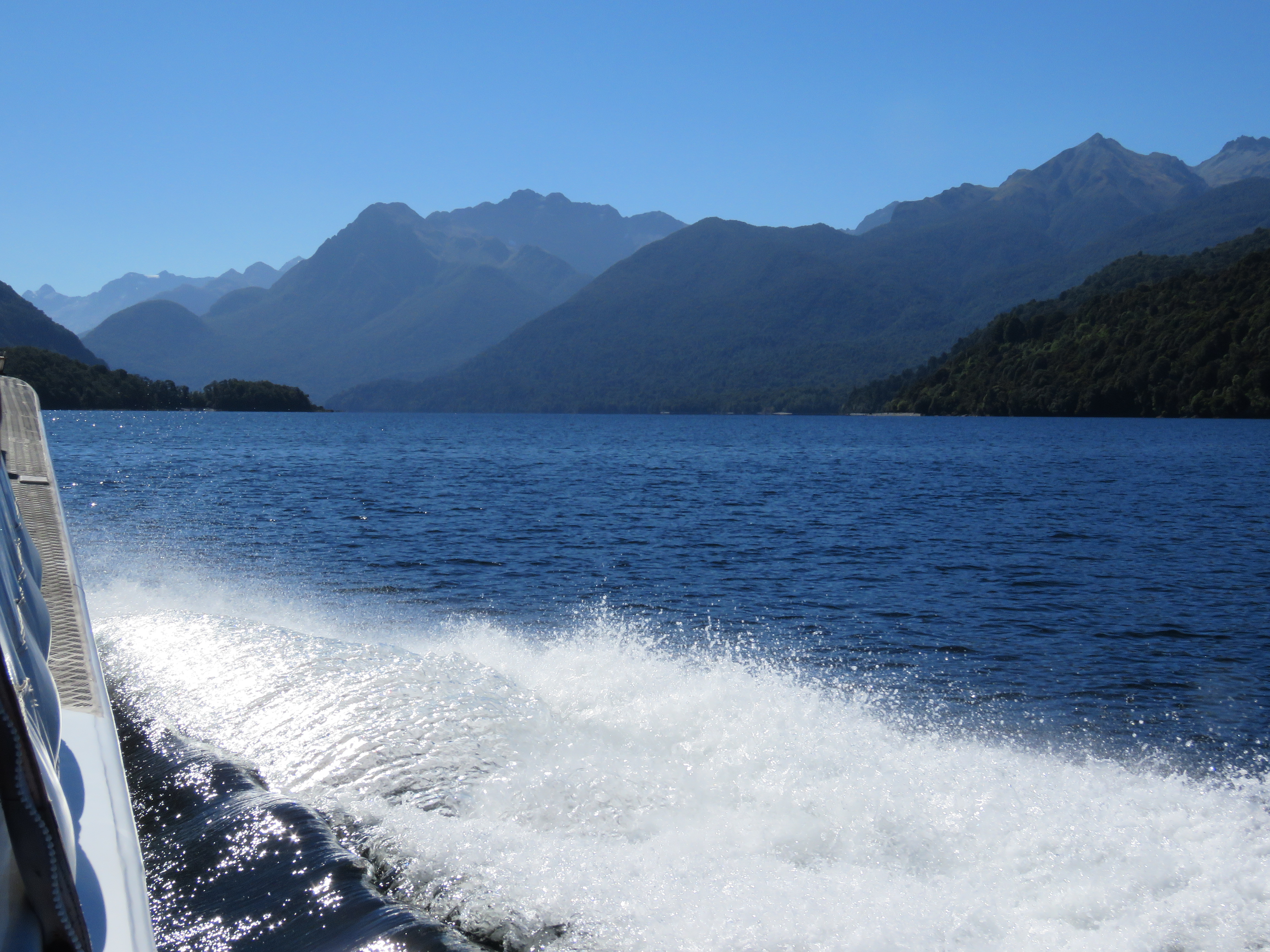
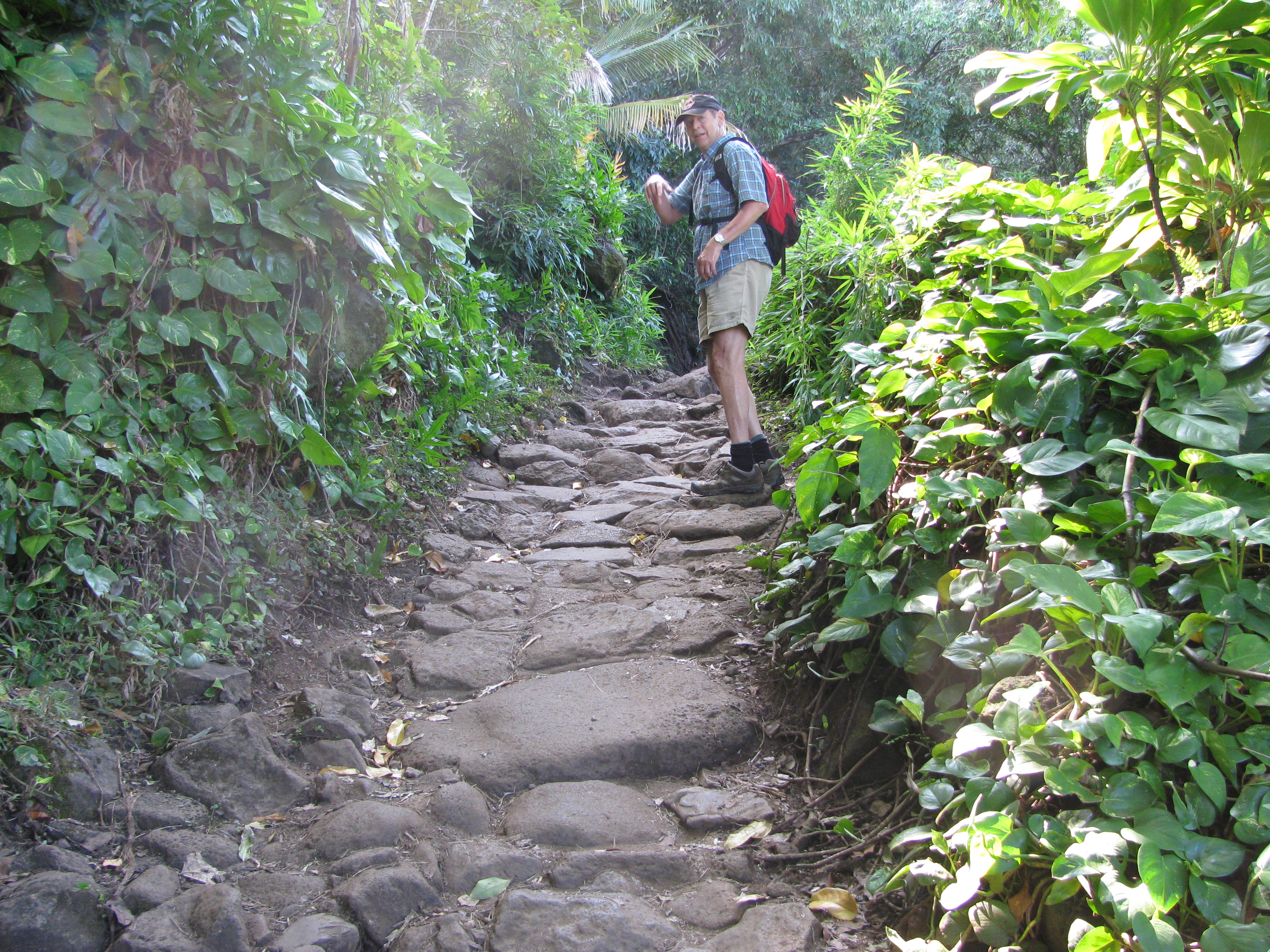
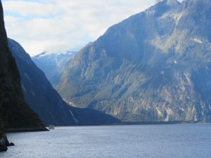
The first day of our adventure was pretty laid-back and was all about getting to the trailhead and our first lodge. We boarded a large bus with our group’s 31 other hikers and three guides and headed through mountain valleys, grassy farmlands and pastures dotted with sheep and cows on our way to Fiordland National Park. They aren’t kidding when they say that New Zealand has a lot of sheep! As soon as we reached Fiordland, we were in beautiful forests and growing mountain peaks. At the edge of the park sits a deep, long and narrow glacial trench called Lake Te Anau. This is where we boarded a boat with about 50 other hikers doing the Milford unguided and rode from the southern edge of the Lake to the northern. This was a beautiful start to our trip as the sky was clear blue and the air was warm. The steep cliffs of Te Anau were beautiful and dramatic and her waters were a majestic turquoise blue. Upon landing, we had a short one-mile hike to Glade House, our first lodge.
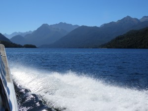
Boat ride on Lake Te Anau to trailhead
At trailhead
Each night of the Milford we stayed in a different lodge along the way, all expertly maintained by Ultimate Hikes. The rooms were monastically appointed and didn’t have any heating but they did have hot showers and good mattresses! Each lodge had sinks, wringers and drying rooms so that we could wash and wear the same clothes each day to reduce the weight we were carrying. The generator was turned off at 10:00pm and was turned on between 6:00 and 6:45am depending on the day. We were instructed to leave our lights on at night so that when they came on in the morning with the generator, this would be our wake up call. This worked pretty well since it was still very dark outside at 6am.
Staff at each lodge prepared great breakfasts and dinners each day. At breakfast, we packed up our lunches and snacks to keep us fortified along our walk. Even with all of my food incompatibilities, I always felt I had enough to eat. They were more than willing to prepare or provide foods without gluten, dairy and soy – which I really appreciated. Compared to our fellow hikers who were doing the Track unguided, we were traveling quite extravagantly. The unguided walkers stayed in bunk-houses without showers, and had to bring their own food, water and sleeping bags.
Aside from feeling nauseous and having lower intestinal cramping, I enjoyed our travels to Glade House. However, after arriving, my digestive system, well, it went haywire and I was left pretty run-down at the end of the day. Evidently, I had some sort of virus that Bill also got but on a much smaller scale – not the state in which we wanted to embark on three more days of long/demanding hiking. Nevertheless, we’re glad we persevered.
Bill decided to carry most of my clothes and gear due to my back issues and lack of energy from being sick. I was moving pretty slowly but not having a lot of weight in my pack helped tremendously.
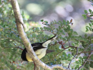
South Island Tomtit
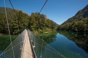
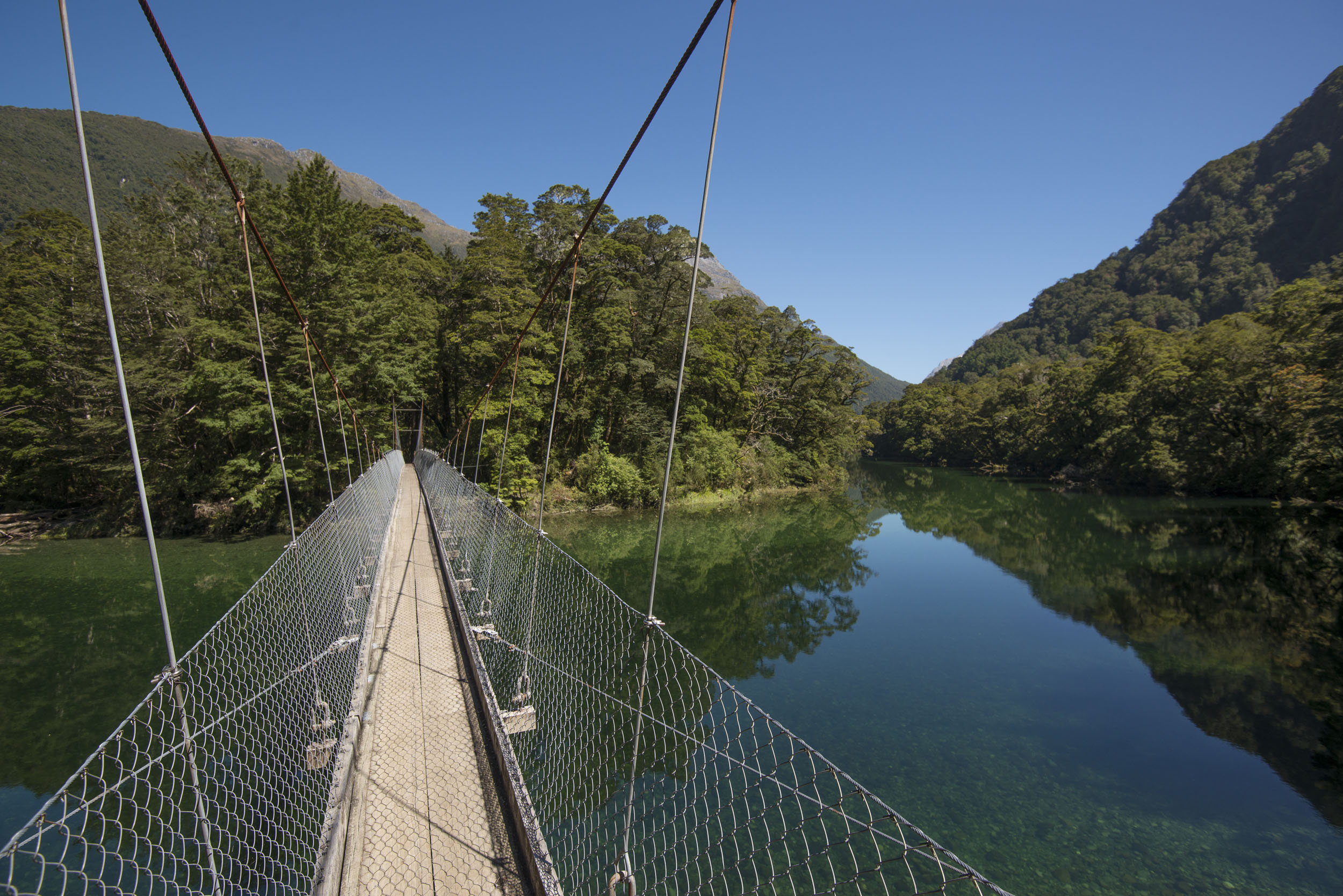
Bridge across Clinton River on Milford Track
Day 2: Beautiful Valley
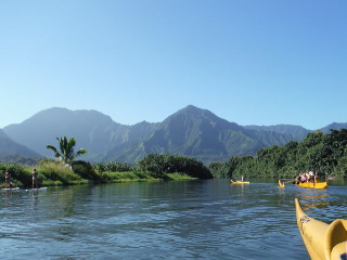
This was our first real hiking day, which entailed walking 10 miles from Glade House to Pompolona Lodge through the Clinton Valley – one of the most beautiful places I’ve ever been. We went over the Clinton River on a long swinging bridge and then followed the river all day. The walk was easy and flat and since we were not under a time crunch, I was able to take several pictures of this valley’s awesome beauty. The granite peaks around us rose nearly straight up into the bright blue sky. The Clinton River was incredibly clear and clean. We were able to see and hear the whistling call of the endangered Whio or Blue Duck in one of the many rushing torrents along the way. As well, we saw the South Island Robin, South Island Tomtit, Bellbird, New Zealand Fantail, Paradise Shellduck and the tiny Rifleman. I had the experience of feeling like this was the real New Zealand, the country I saw amazing pictures of on TV, the place where The Hobbit and Tolkien’s trilogy were filmed because of its beauty and incredibly rugged landscape. The peaks around us made me feel dwarfed and tiny by comparison in both my size and importance in this big space. What an amazing opportunity to experience such grandeur first hand.
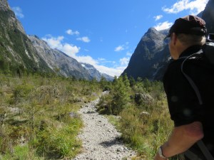
Hiking the Clinton Valley
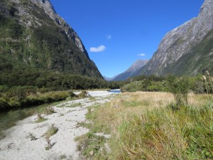
Along the Clinton River
The trail was well maintained and was rerouted in several places due to erosion from storms and river damage. Pole markers along the way were placed to denote the track in flooding situations. We were happy to have the sun and warmth but could see clouds gathering ahead of us – an omen of the next day’s weather.
As we came to a clearing on the valley floor, we were able to catch a view of MacKinnon Pass and the hut at the top where we would have lunch the next day at about 3,300 ft. It was at once both an exciting and incredibly scary sight for me. As a 25 year old, I had backpacked with a lot more weight on my back and had gone up much higher peaks in a day, but 25 years later, I had a lot of anxiety about this mere 2,000 foot climb.
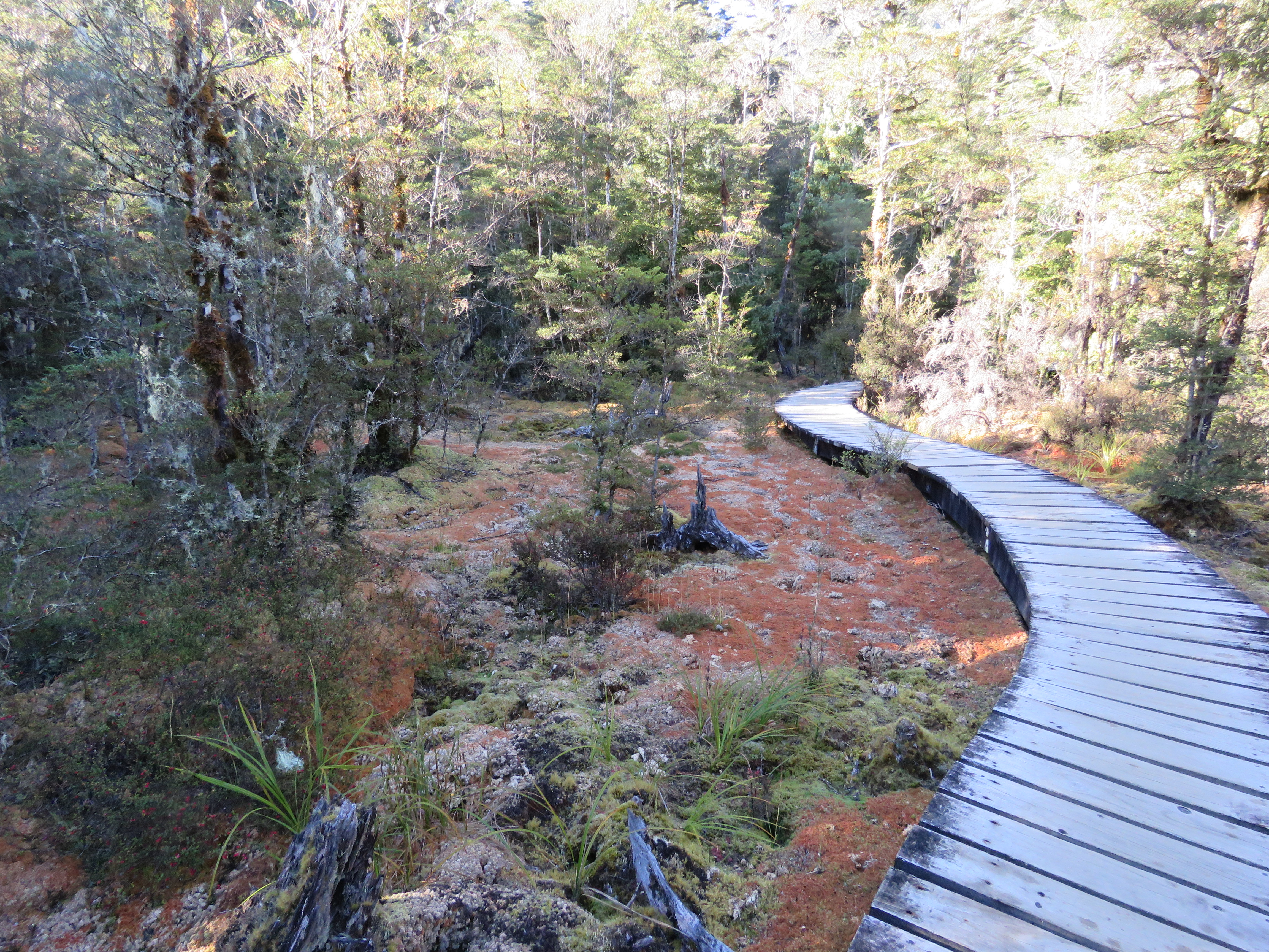
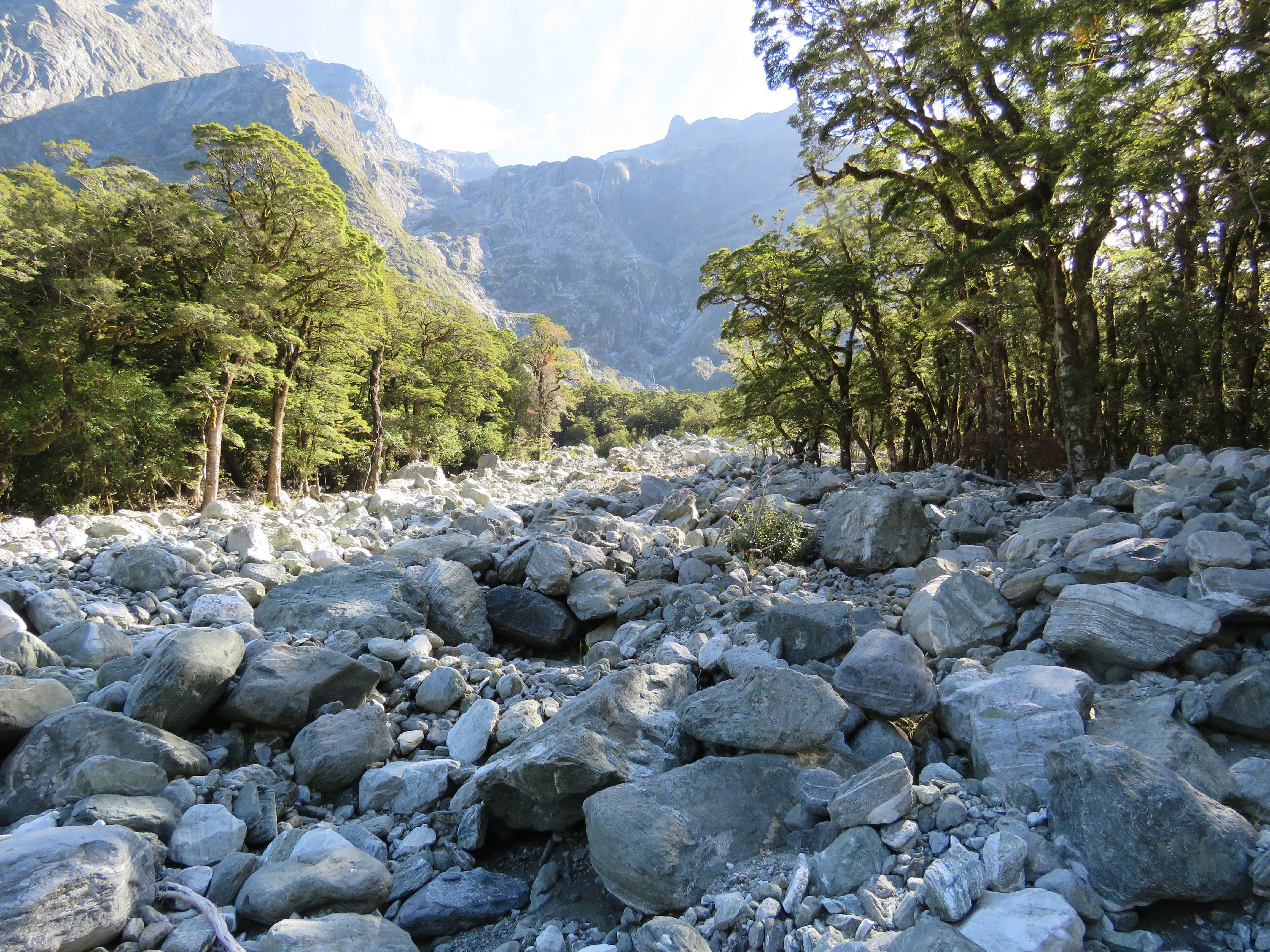
As we walked further into Fiordland and closer to the ocean, we could see the forest flora slowly changing into rain forest terrain with many different types of ferns as well as mosses growing on the trees. The vegetation grew thicker and the air was more humid.

Wetlands

Quick-rising, underground river
At the end of the day, we were exhausted but we made it to our lodge room at about 3:00, which provided time to do our laundry, take a shower, and take a short nap before reporting for dinner at about 6:30. Pompolona Lodge was like a big tree house with many branches. It was nestled on an incline with trees growing up all around. We walked everywhere on boardwalks and had beautiful views of the valley and MacKinnon Pass high above. At dinner we enjoyed a little wine and great conversation with a couple from Sydney before getting a briefing of day three’s adventure. We got to our beds just before the lights went out at 10:00. After walking 10 miles on low-energy, you’d think I’d sleep really well, but evidently my adrenal system was busy revving up for our big hike the next day.
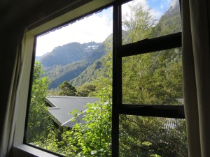
View from Pompolona Lodge
Day 3: The Dragons Awaken
On day three the generator came on at 6:15 to a light rain. We had to eat breakfast, make lunch and pack everything up to be on the track by 7:35 and we weren’t going to be late. Bill and I had a speedy and efficient system worked out for getting dressed and out the door quickly. However, this was the first day we needed to get our rain gear and hiking poles out and that took extra time for which we hadn’t prepared. Nevertheless, we were on the trail by 7:45.
After walking for at least 45 to 60 minutes we hadn’t seen anyone around. This started to worry me as we approached the base of the MacKinnon Pass. I started to grow concerned that perhaps the last guide had already left ahead of us and didn’t realize we were still at the lodge. The further we went along the trail, the more worried I got that we had been left behind as it were and that nobody knew where we were. Finally, my fears were put to rest when our guide Akiko joined us from behind with a cheerful, “Hello Bill and Diane!” I was so relieved to know that we weren’t alone in this big wild place. Looking back, I realize I was overreacting but this was just the first of many fears and challenges I would face on the nine-mile hike to Quintin Lodge.
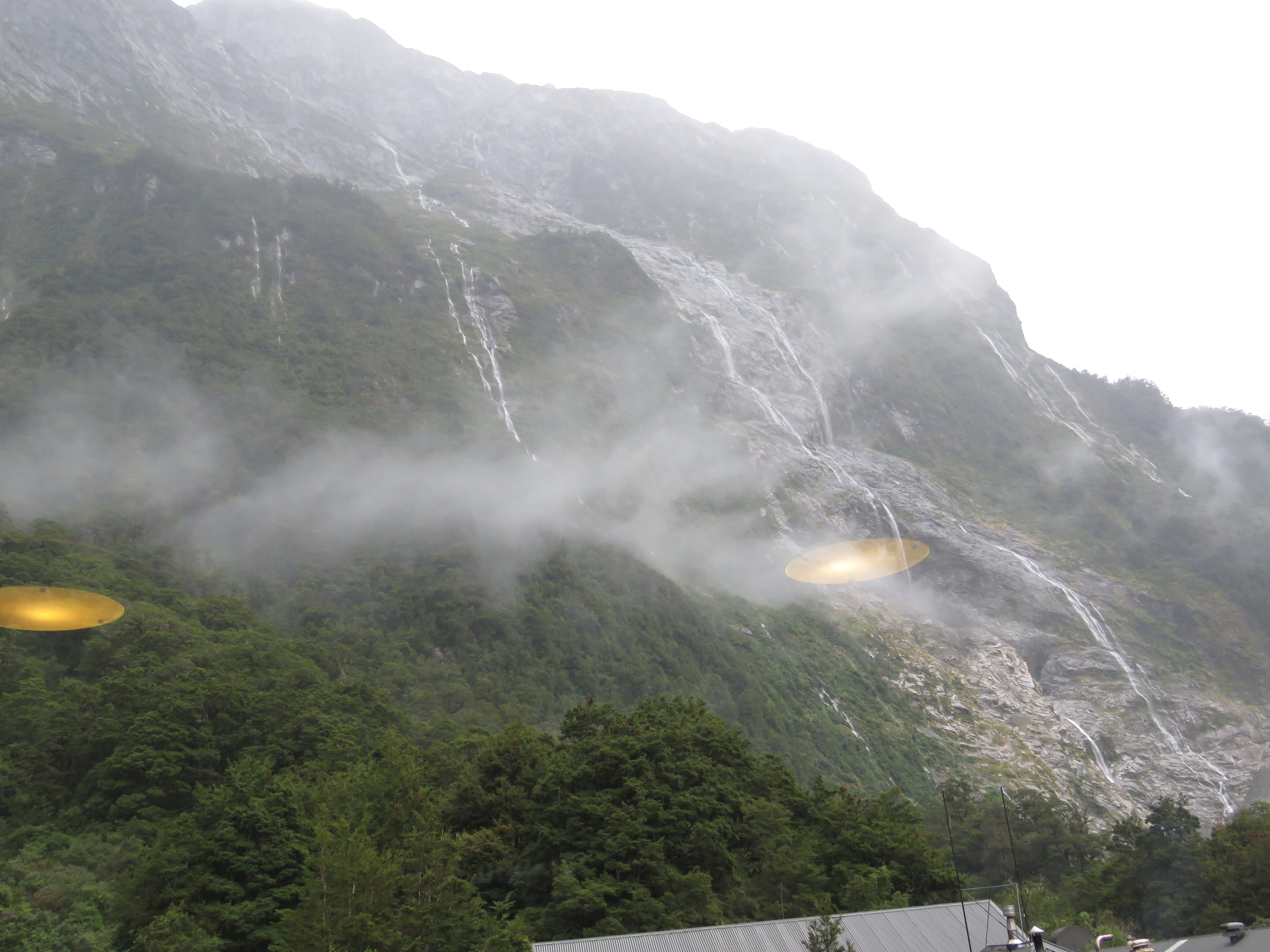
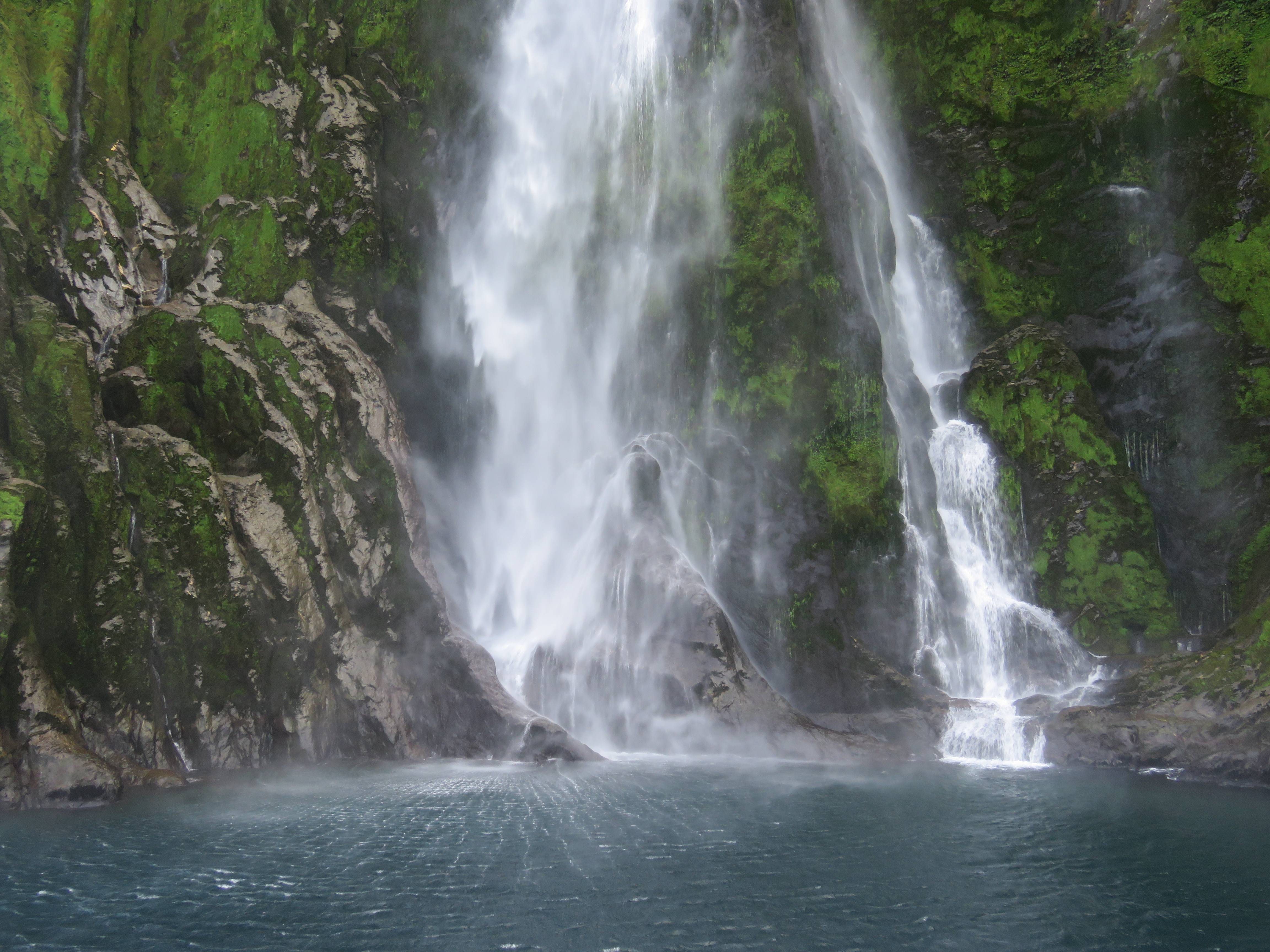
I think most people would wish for clear, dry weather as they go over a pass high above beautiful rivers and valleys. After all, it’s nice to see the beautiful view, and all of the Milford Track brochures show a gorgeous blue-sky vista from the top of MacKinnon Pass. However, this was not one of those days. It rained literally all day, sometimes a light mist and other times it really rained. Nevertheless, the rain dragon came with a pot of silver because the mountainsides burst alive with loads of beautiful streaming waterfalls. Each turn of the trail going up the pass there were gorgeous strands of water falling hundreds of feet. We realized that this sight would not have been possible if not for the rain.
As we went higher and higher up the side of the pass and climbed above the tree-line, my next dragon reared its ugly head, that of acrophobia. Even though I had poles to give me balance and good boots, my fear of falling off the edge of this mountain was pretty intense. Back home, if you’re walking on wet rocks, they are very slippery. It took me a while but I realized that my boots were not slipping at all on the granite boulders we were tramping across. This helped to allay my fears of hurtling off the edge but then my fear of Bill doing this became even more intense. At one point, Bill was about 30 feet in front of me and got his foot caught on a rock. He fell towards the downward (cliff) edge of the trail and for a split second, as he fell, I thought he was going over the edge. In a millisecond, my biggest fear was coming true and it felt as if my life was about to change forever. I screamed just as Bill let out a big grunt as he fell onto the large boulder next to the trail that broke his fall. I was so relieved and also so full of anxiety that I wanted to just stop right there on the track and cry. But I didn’t.
At some point, Bill and Akiko realized that I was walking very slowly. I didn’t realize that my pace was that sluggish but I guess I was still recuperating from my gut problems and I just didn’t have my usual energy back yet. Akiko kept asking if I would let her carry my pack and I said no several times but finally relented about half way up the pass. My extra pack didn’t slow this woman down a bit. This was her 25th time doing the Milford and she viewed carrying extra packs as a good workout! What a relief this was. Akiko amazed me again at the top of the pass as she offered us hot tea and orange drink she poured out of canteens that were stuffed in her pack. This bit of warmth was heavenly up there because the 30-minute jaunt to the Pass Hut was beautiful but not a walk in the park.
The wind at the top of the pass turned the raindrops into little pellets of ice. Even though I had a raincoat and rain pants on, I quickly got very chilled and couldn’t get the to the hut fast enough! My hands were frozen and wet under my fleece gloves and all of my clothes were wet from sweat. At one point I thought I might get blown off the edge but I crouched down and finally made it to a less windy patch of trail. Once reaching the hut, I finally let all the tears run as I stood under a heat lamp drinking hot tea and holding a hot water bottle on my belly.
For about ten minutes I was just speechless. I don’t know if I was in shock, had the beginnings of hypothermia or was just in disbelief that I actually made it to the top. I finally regained my senses and began to process where I was and that the walk down was still ahead. As far as we had gone vertically, we still had that many miles to go down on the other side of the misty pass and then to Quintin Lodge.
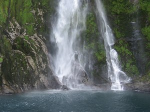
We had a short break to eat and drink warm beverages before heading down the mountain. Our guide, Fe offered to carry my pack the rest of the way to the Lodge and I took her up on it. We were the last walkers off the pass and I knew I needed the help. We started out at a good pace and our poles proved to be really helpful in maintaining balance. The trail down was much steeper than the trail up but it too provided an amazingly beautiful show. As we descended the pass, we came to a huge rounded area replete with cascades. Later, one of our fellow walkers described it as, “an amphitheater of waterfalls.” It was so beautiful I had to stop briefly several times just to take it in. At times we had to walk through some of these waterfalls running down the mountain. The rocks took on a beautiful green color.
The back pain I felt coming up the pass was nothing compared to the pain in my left knee and ankle on the way down. My final dragon to slay was to persevere through physical pain and exhaustion as we made our way through this amazing place. Once we reached the tree line again, the track became a series of wooden steps and walkways along the side of a beautiful raging waterfall that pooled and fell many times. Even though it had been raining all day, the water through this area was still crystal clear. We sang songs and had great conversations with Fe along the way. It was truly a relief and comfort to have Akiko and Fe with us this day. I fear I’d still be out there in the wilderness somewhere if not for their help!
Upon arriving to Quintin Lodge, we were beyond exhausted. We showered but didn’t have enough time to clean our clothes and hang them up to dry until after dinner. As you can imagine, space in the drying rooms was hard to come by since the whole group arrived sopping wet from sweat and being in the rain all day. Nevertheless, dinner that night was sweet and relaxing. We were all a little high from our accomplishment and the beauty that nature provided to us. Surprisingly, it took me a while to get to sleep. I scrawled a few words about the day in my little notebook and ended with, “The waterfalls and amazing views here were beyond description, but I’ll try to write about it sometime anyway. Amazing adventure.”

Waterfalls above Quintin Lodge (please excuse the reflections!)
Day 4: Many Miles to Milford Sound
We awoke at 6am to a light mist and quickly got ourselves fed, geared up and on the trail by 7:30. We had a long 13 mile walk ahead of us and needed to make it to Sandfly Point by 4:00pm to catch the last ferry to Mitre Peak Lodge. Our boots were still pretty wet as we put them on but our wool socks kept us comfortable. Thankfully, the morning mist cleared away and we were able to ditch our rain gear within 30 minutes. We started out at a good pace but soon enough, an area on my left ankle where my boot had rubbed the day before was causing me a lot of pain. At one of the huts along the way, our guide Logan wrapped it up for me using foam pads and tape. This was a real help – once again our guides were exceedingly helpful.
The closer we got to Milford Sound meant that stopping for any length of time would bring on a swarm of biting sand flies, so our breaks were short. The sand flies were fast biters and leave a nasty, itchy welt that lasts for a week or more. I’m usually a magnet for biting bugs and today was no exception. We saw the Kea parrot and a pair of noisy Western Weka along the trail where we stopped for lunch. The Weka is one of several flightless birds found only in New Zealand and is, like so many others, vulnerable to extinction.
Once again, Bill and I found ourselves bringing up the tail of the group but it was nice to talk to Akiko about her life and her home country of Japan. I was again thankful to her for taking my pack about one-third of the way in. The views of the valley, river, waterfalls and Lake Ana along the way were breathtaking. We saw a pair of beautiful Brown Teals in the lake and paused to take them in.
With four or five miles still to go, I realized that I was walking pretty slowly and felt very tired. Unfortunately, we didn’t have time to take a break. If we were going to make the boat, we were going to have to make up some serious time. So at the coaxing of Bill and Akiko, I had some more juice drink and ate some chocolate. This powered me up a bit and allowed me to charge through the next several miles – and then the exhaustion really hit! I was completely aware that I was pushing way beyond what my body was willing to do but I had no choice but to keep putting one foot in front of the other.
As I continued to push myself way beyond my physical comfort zone, the beauty all around me amazed me again and again and transported my mind away from exhaustion and pain. We were deep into rain forest conditions now. The vegetation was so thick you couldn’t see more than about 10 feet into the woods due to the Spanish moss, ferns and vines. I remarked several times how amazing it was to see so many different kinds of ferns – tiny ones, huge ones, and the most beautiful ones that looked like starfish. Not surprisingly, the national icon for New Zealand is a Silver fern. We hiked over several more high swinging bridges that passed over rushing rivers and beautiful ravines.
At about one mile to go, it was quite a relief to realize that we had enough time to make the boat without rushing. As we approached the end of the trail, my conversation with Akiko finally wended itself to the topic of Buddhism. Growing up in Japan, her experience of it was very different than mine. As I related to her my own understanding of Buddhism and the Dharma, I remarked that I felt disappointed that we hadn’t started talking about it before we had only a quarter mile to go. I was eager to hear about what growing up in a culture heavily influenced by Buddhism was like. I don’t remember Akiko’s exact words but she said something to the effect that, “I guess we needed 33 miles before we could get to this topic.” As I look back on that conversation, she was right. It took all those miles to just get to where I was all along. I realized that I had just gone on a very long journey and yet I hadn’t really gone anywhere.
The Milford Track ends at Sandfly Point which, as you might guess, is sandfly central. Gratefully, we had an enclosed cabin in which to retreat from their bites and were supplied with lots of cookies, juice and smiles from our guides and other very exhausted hikers. With 15 minutes to spare, it was such a relief to make it to the end in one piece. As the ferry puttered along the short jaunt from Sandfly Point to town, the view turned from beautiful to spectacular as Milford Sound came into view. Steep, jagged granite cliffs descended into amazing, jade-shaded water. A huge waterfall greeted us as we entered the port area. Looking down the sound toward the Tasman Sea was simply breathtaking.
Arriving at Mitre Peak Lodge was a bit surreal due to my level of weariness. That night we enjoyed celebrating our accomplishment together. After another great meal, the guides lead a short ceremony where each hiker received a certificate of accomplishment. About half of the group stayed up to continue celebrating and sharing stories but Bill and I were in the overspent and fried group that went to bed as soon as we could! Before falling asleep, I realized that I had used every resource I could muster on this amazing 33.5-mile trek to the Milford Sound. There have been many times in my life that have been challenging, where I had to persevere through real difficulties. By utilizing all of my coping resources, I somehow made it through those tough times. I felt relieved that once again, I had defeated my personal scary dragons and had lived to tell the tale.

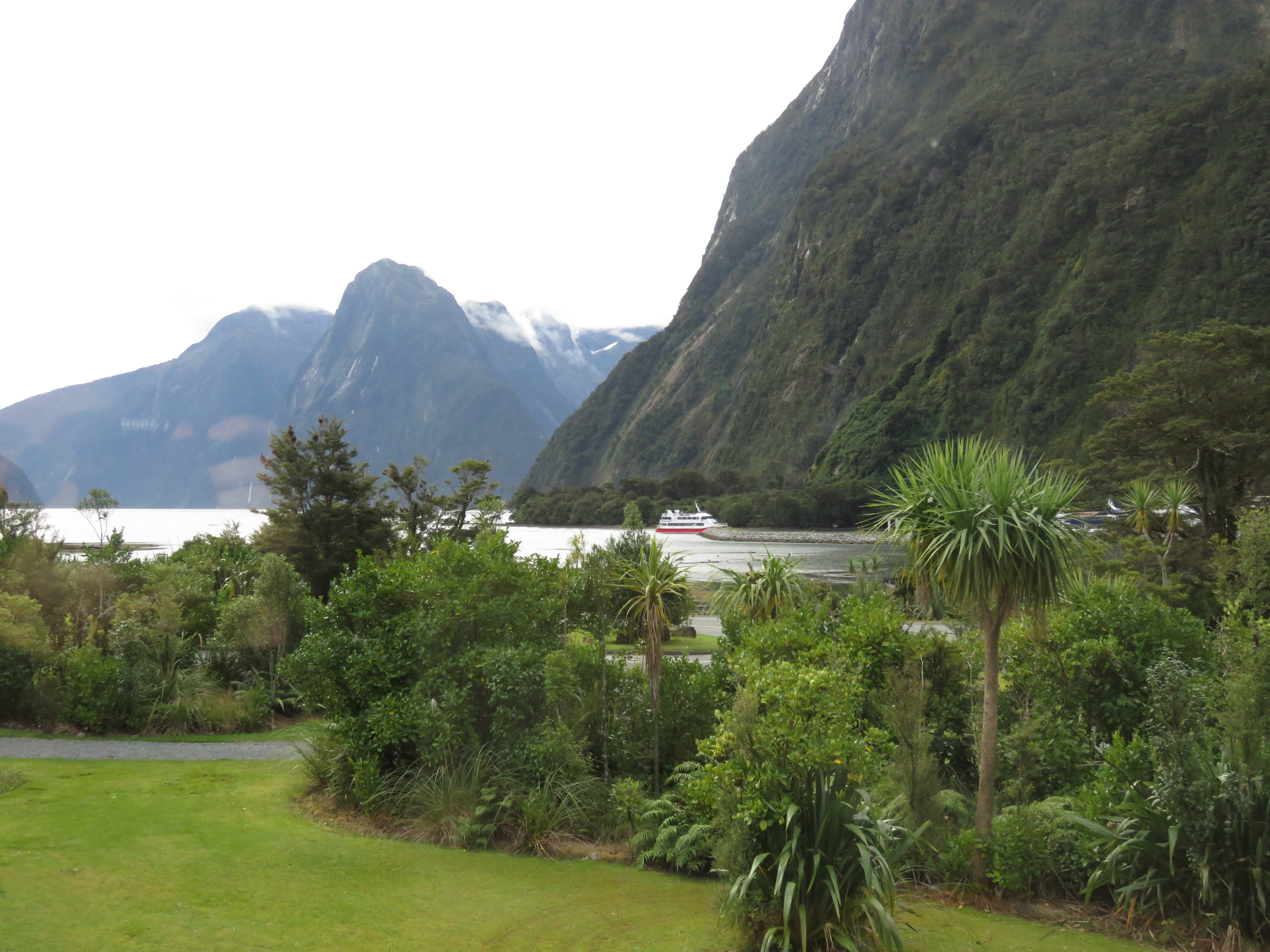
View of Milford Sound from Mitre Peak Lodge
Day 5: Milford Sound to the Tasman Sea
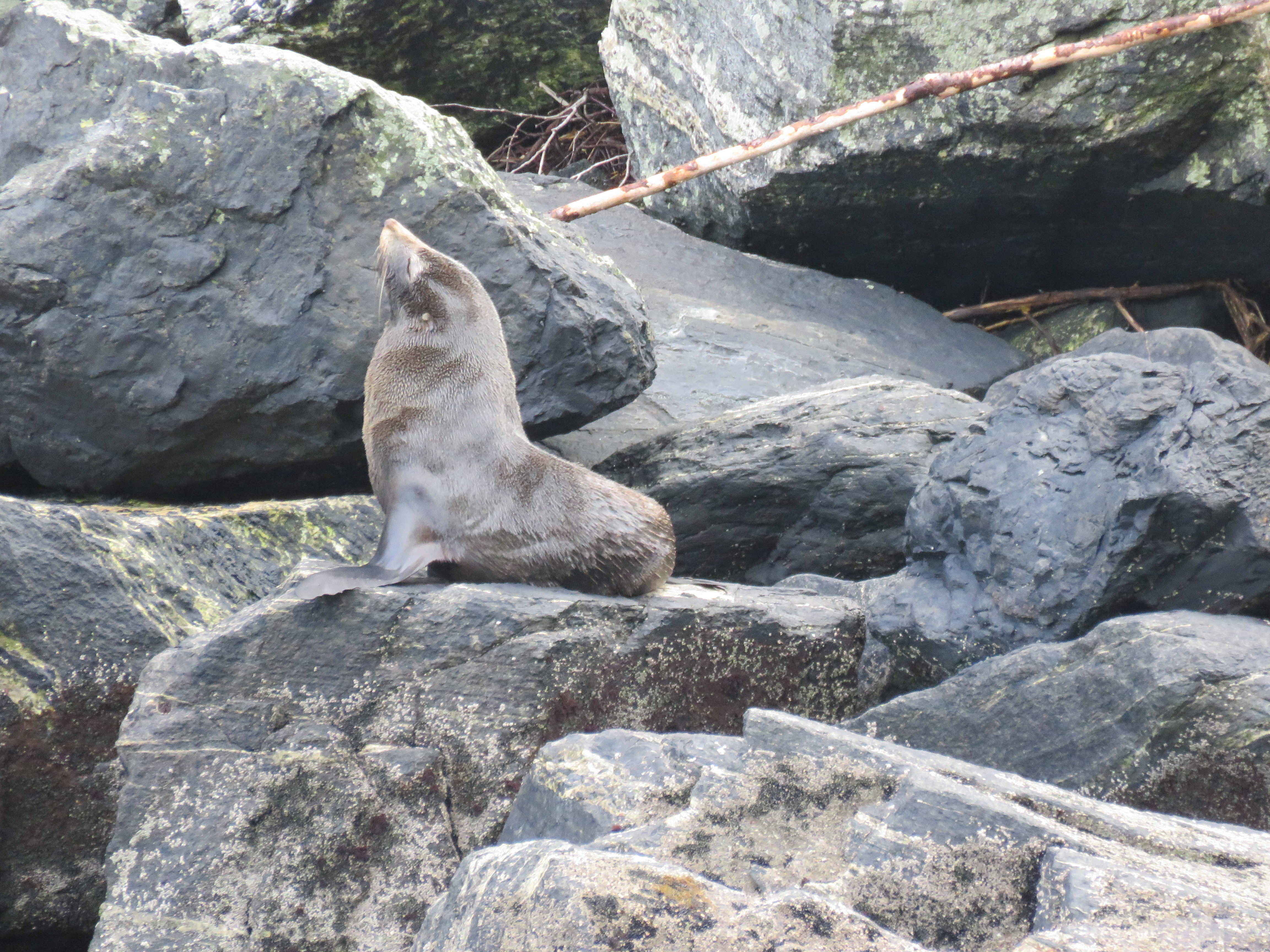
The last day of our journey included a two-hour cruise through the Milford Sound and a long bus ride back to Queenstown. Still weary from 13 miles of walking the day before, we boarded a small, day cruise ship at 9 am and headed towards the Tasman Sea at the mouth of Milford. Once again, words fail to express the beauty and magnitude of this amazing place. The view from our lodge was spectacular and as we traveled down the sound, it just got more and more amazing. Steep cliff walls came directly into the turquoise water, leaving little room for fur seals and shags (cormorants) to take a break. Waterfalls flowed down hundreds of feet and misted the air. The few boats in the sound looked dwarfed in comparison. As we neared the Tasman Sea, we caught a view of the coast and looked out on the vast expanse of water that lies between New Zealand and Australia – about 1,000 miles northwest of Fiordland.

Milford Sound from harbor
Milford Sound with boat and glacier
It turns out that Milford Sound is actually not a sound but a fjord. After its naming, they discovered that this cavernous expanse was actually carved by an ancient glacier and not a river. It was curious to think that the same forces that created our beloved Cayuga Lake and all of the Finger Lakes in upstate New York also created this massive water valley. To give perspective, Milford fjord is 1,680 feet deep, 2 miles wide, has peaks as high as 6,700 feet and is 12 miles long. In some ways it dwarfs Cayuga Lake which is 435 feet deep, averages 1.7 miles in width, has cliffs of 200 feet high but is almost 40 miles long.
Beautiful waterfall in Milford Sound
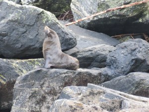
Fur Seal
With 264 inches of rain per year, Milford Sound is the wettest inhabited place in New Zealand and one of the wettest on the planet. It rains 182 days per year there. As we experienced on the Track, when it rains in the Milford, hundreds of temporary waterfalls form and then disappear a few days after the rain has stopped. Some of the waterfalls never reach the Sound as they are blown and turned to mist before reaching it.
I’m not a real fan of riding busses but the several-hour ride back to Queenstown has to be the most spectacular bus ride I’ve ever been on. Just after leaving town, we traveled up to the opening of Homer Tunnel that is only open in the peak summer months due to the risk of avalanches in winter. Depression era relief workers dug it between 1935 and 1954. Construction started with just five men with pick axes and wheelbarrows and was halted several times during WWII, and due to avalanches and water seepage into the tunnel. Its narrow granite walls are still unlined and appeared very close as we passed through this .75 rough-hewn passageway.
As the bus traveled through Fiordland National Park we took in astoundingly beautiful mountains, and crystal clean rivers and reminisced about our amazing trek from Lake Te Anau to Milford Sound through this wonderful place.
Looking back …
As I look back on the whole experience, I realize that I was filled with fears and anxiety a lot of the time, but I think it’s best to remember and live again in those moments of complete awe of the earth’s beauty, and to relive the knowing that this was something really scary for me and I persevered through it.